
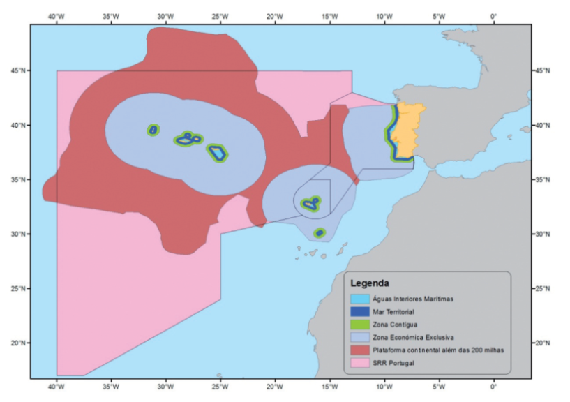
This sea zone, adjacent to territorial sea, shall not exceed 200 nautical miles from the baseline. The EEZ includes the contiguous zone. In the EEZ, coastal States exercise their sovereignty and jurisdiction pursuant to UNCLOS, holding the right to exploit, manage and conserve the existing living and non-living natural resources, from the waters overlying the seabed, from the seabed and its subsoil, including the exploration and exploitation of renewable energy resources, like wind, waves and sea currents.
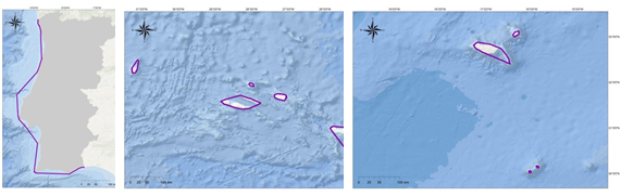
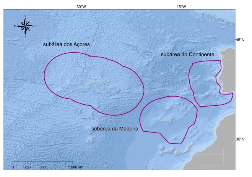
Thus, coastal States can authorize, construct and regulate the construction of infrastructures for the exploitation of natural resources, including the possibility of installing artificial islands, on the EEZ. They can define safety zones, generally up to a maximum of 500 m from the limits of such infrastructures, which must be seen by ships in transit. The Portuguese EEZ comprises 3 subareas: subarea of the continent (287 521 km2), subarea of Azores (930 687 Km2) and subarea of Madeira (442 248 Km2).
The continental geological platform concerns the portion of the bed and subsoil of submarine areas which, starting at the coastline, extend with a gentle slope up to a mean depth somewhere between 200 and 300 meters in the transition of the continental slope.
However, and according to n.º 4 of Article 76 of the Convention, the coastal State may establish the outer limit of its continental shelf beyond 200 nautical miles in accordance with scientific criteria. In 2009, Portugal submitted to the Commission on the Limits of the Continental Shelf (CLCS) the demarcation of its continental shelf outer limits beyond 200 nautical miles. The outer continental shelf was submitted considering 3 regions: eastern region - comprising the extension of the platform relating to Madeira archipelago and the mainland; the western region - comprising the extension relating to Azores archipelago; and the Bank of Galicia region, which is an area of common interest to Portugal and Spain, still not divided by bilateral agreement.
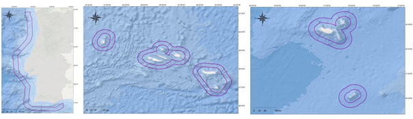
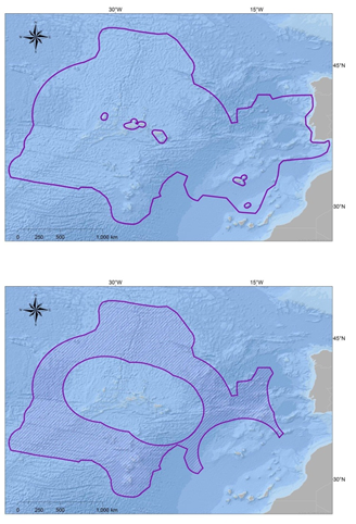
In 2007, these limits were modified by IMO (International Maritime Organization)’s circular SAR.8 / Circ.1 / Corr.5, of April 23rd and maintained in IMO’s circular SAR.8 / Circ. 4 of December 1st, 2012. These internationally agreed latest changes have not yet been transposed to national legislation that formally defines the space of responsibility. The national Search and Rescue Region (SRR) is divided into three subareas.
Coordination of maritime search and rescue operations is carried out in control centres at Lisbon, Ponta Delgada and Funchal. In total, Portugal is responsible for ensuring this service in a geographic space of about 5,754,848 Km2, 572,914 Km2 of which correspond to SRR Lisboa (mainland and Madeira) and 5,181,934 Km2 to SRR Santa Maria (Azores).
The definition of each coastal country’s liability limits (from the SAR Convention) is based on voluntarism, its specific interests and on the basis of agreements with neighbouring countries. Although coordination of these administrative processes is carried out by an international IMO organization, there are some spaces with overlapping or void responsibilities.
Currently, there is a zone which is empty of responsibilities, adjacent to Portugal SAR zone, southwest of Madeira’s archipelago. This space has already had overlapping responsibilities from both Portugal and Spain, but in the process of adjusting boundaries, a mismatch led to both countries withdrawing simultaneously from their coverage, originating the current void.